Reading a Compass Without Getting Confused: Visual Step-by-Step Guide

Table of Contents
- Introduction: Why Compass Navigation Still Matters in 2026
- Understanding Your Compass: Anatomy Made Simple
- Step 1: Orienting Your Map Using the Compass
- Step 2: Taking a Bearing to a Landmark
- Step 3: Following Your Bearing Accurately
- Step 4: Finding Your Location with Triangulation
- Understanding Magnetic Declination: The Critical Factor
- Common Mistakes and How to Avoid Them
- Practice Exercises for Building Confidence
- Conclusion
- Frequently Asked Questions
Introduction: Why Compass Navigation Still Matters in 2026
The hiking group stood motionless at the trail junction, phones held aloft searching for signal, battery indicators flashing red warnings that meant little good in the gathering darkness. Three hours earlier, they had confidently left the main trail relying entirely on GPS navigation, never imagining that dense forest canopy combined with a sudden winter storm would render their technology useless. One member eventually extracted a forgotten compass from his pack’s bottom, but nobody knew how to use it. What should have been a straightforward return route became an expensive helicopter rescue that made regional news and spawned countless online debates about technology dependence versus traditional skills. This scenario, far from rare, plays out regularly across wilderness areas worldwide as modern navigators discover that reliable wayfinding requires skills transcending battery life and satellite visibility.
Compass navigation represents humanity’s time-tested solution to the fundamental challenge of determining direction and maintaining course across landscapes lacking obvious reference points. For over a thousand years, magnetic compasses have guided explorers, traders, and adventurers through environments where getting lost meant not just embarrassment but potential death from exposure, dehydration, or injury. Modern wilderness navigation programs offered through national parks continue this educational tradition, teaching compass skills to new generations of outdoor enthusiasts. Structured courses combine theoretical knowledge with practical field experience in protected landscapes. The basic principles remain unchanged despite technological advancement: a magnetized needle responds to Earth’s magnetic field, pointing reliably toward magnetic north regardless of weather conditions, battery status, or satellite constellation positions. This elegant simplicity explains why navigation experts universally recommend carrying and knowing how to use a compass even when hiking with the latest GPS technology.
While the following video highlights the basic skills for using a map and compass accurately, there is still information below this article that you may not yet be aware of :
The confusion many people experience when first attempting compass navigation stems not from inherent complexity but from poor instructional approaches that emphasize memorizing procedures without fostering genuine understanding of underlying principles. Traditional compass instruction often buries beginners under jargon about azimuths, back bearings, and magnetic variation before they’ve grasped basic concepts like why the needle points north or what those degree numbers actually represent. This backward approach creates frustration and abandonment, leaving people convinced they lack some special spatial reasoning ability required for navigation. In reality, compass use breaks down into a handful of straightforward techniques that become intuitive with proper explanation and minimal practice.
The visual learning revolution sweeping education during the 2020s offers powerful tools for demystifying compass navigation through clear diagrams, step-by-step photographs, and interactive demonstrations that traditional text-only instruction cannot match. Our brains process visual information sixty thousand times faster than text, making pictorial guides ideal for spatial skills like navigation. A single well-designed diagram showing how to align a compass with a map communicates more effectively than paragraphs of text describing the same process. This visual approach particularly benefits people who struggled with traditional compass instruction, opening navigation skills to audiences previously convinced such knowledge lay beyond their grasp.
Modern wilderness travel presents paradoxical challenges where technology simultaneously makes navigation easier and more dangerous. GPS devices and smartphone apps provide unprecedented accuracy and convenience, allowing even novice hikers to follow complex routes through unfamiliar terrain with confidence. This capability encourages people to venture into increasingly remote areas without developing traditional navigation skills or backup capabilities. When technology inevitably fails through battery depletion, water damage, impact breakage, or simple satellite signal loss, these adventurers find themselves genuinely lost with no fallback options. Understanding what to do when genuinely disoriented requires pre-planned protocols extending beyond pure navigation skills. Mental preparation and systematic decision-making prevent panic-driven mistakes that worsen emergency situations. The resulting rescues strain emergency services and sometimes end in tragedy when circumstances prevent timely assistance. Developing compass competency provides essential insurance against technology’s limitations while requiring minimal additional gear weight or expense.
Environmental conditions that degrade GPS reliability actually enhance compass performance in several important ways. Heavy forest canopy blocking satellite signals has zero effect on magnetic compass function. Canyon walls preventing position fixes don’t interfere with magnetic field detection. Extreme cold that rapidly drains batteries leaves mechanical compasses completely unaffected. Even electromagnetic disturbances from solar storms that can disrupt GPS satellites have negligible impact on handheld compass accuracy in most situations. This complementary relationship between technologies argues for carrying both tools but developing sufficient compass proficiency to navigate entirely without electronics when circumstances require.
The psychological benefits of compass competency extend beyond practical navigation utility to encompass confidence, self-reliance, and deeper engagement with outdoor environments. Hikers who understand navigation feel empowered to explore beyond established trails, discovering spectacular locations that remain unknown to those confined to marked paths. This expanded access to wilderness experiences justifies time invested in skill development even for people who primarily use GPS. Additionally, actively navigating with map and compass forces continuous environmental awareness impossible when blindly following GPS directions. You notice terrain features, track distances covered, and develop instinctive understanding of landscape patterns that pure GPS navigation never cultivates. This engagement transforms hiking from exercise into genuine exploration.
Commercial interests have created misconception that compass navigation requires expensive specialized equipment beyond most people’s budgets. In reality, perfectly adequate baseplate compasses cost less than most water bottles, while free topographic maps available from USGS and other sources provide all the cartographic information needed for competent navigation. The total investment for complete navigation capability runs under fifty dollars, less than most people spend on a single restaurant meal. This accessibility means economic barriers don’t prevent anyone motivated to learn these skills from acquiring necessary tools. The real limitation lies not in equipment costs but in finding quality instruction that makes compass use comprehensible rather than mystifying.
This comprehensive guide aims to eliminate confusion surrounding compass navigation through clear visual demonstrations of each essential technique accompanied by plain-language explanations that build understanding from first principles. We will examine every component of a baseplate compass, explaining both function and proper use in terms anyone can grasp. Step-by-step photographic sequences will illustrate fundamental skills from orienting your map to triangulating your position. Common mistakes that cause beginners frustration receive explicit attention with specific guidance for avoiding these pitfalls. Practice exercises progress logically from simple to complex, building confidence through achievable challenges. By guide’s end, readers will possess not just procedural knowledge of compass techniques but genuine comprehension that enables adaptation to varied situations and problem-solving when circumstances differ from textbook examples.
The journey from compass confusion to navigation competence requires less time and effort than most people imagine. Unlike many outdoor skills demanding significant physical conditioning or expensive equipment, compass navigation rewards mental effort more than athletic ability or financial resources. A weekend of focused practice typically suffices for most people to achieve functional proficiency adequate for common navigation tasks. Mastery develops through experience over subsequent trips, but basic competence emerges surprisingly quickly when instruction emphasizes understanding over rote memorization. This relatively low barrier to entry makes compass navigation one of the highest-value skills any outdoor enthusiast can develop measured by effort required versus safety and capability benefits gained.
[INSERT IMAGE 1 HERE]
Understanding Your Compass: Anatomy Made Simple
Before attempting navigation techniques, you must understand what you’re holding and why each component exists. A baseplate compass consists of several distinct parts working together to accomplish one fundamental task: helping you determine and maintain direction across terrain where natural reference points prove unreliable. Examining each component’s purpose rather than just its name builds the comprehension foundation supporting successful technique application later.
The magnetized needle represents your compass’s heart, a lightweight balanced rod with one end seeking magnetic north through interaction with Earth’s magnetic field. Manufacturers typically color the north-seeking end red while leaving the opposite end white or black, though some compasses use different color schemes. This needle floats freely suspended on a low-friction pivot point allowing it to rotate without resistance in response to magnetic forces. The needle sits inside a sealed capsule filled with damping liquid, usually mineral oil or similar fluid, that slows needle movement preventing wild oscillations every time the compass shifts position. This stabilization lets you take accurate readings despite minor hand tremors or movement inherent in field conditions.
The rotating bezel surrounds the needle housing with degree markings measuring from 0 to 360, representing the full circle of possible directions. Zero degrees aligns with north by convention, 90 degrees marks east, 180 indicates south, and 270 points west. Quality compasses mark every 2 degrees around the bezel providing precision adequate for hiking and backpacking, while cheaper models might only mark 5 or 10-degree intervals reducing accuracy. You rotate this bezel independently of the baseplate, a crucial feature enabling various navigation techniques we’ll explore later. Some compasses incorporate click-stops at cardinal directions providing tactile feedback when rotating the bezel, helpful when taking readings with gloved hands or in darkness.
The baseplate forms the transparent platform holding all other components while serving multiple navigation functions itself. Transparency proves essential because you’ll frequently place the compass directly on maps, needing to see cartographic features through the plastic. One or more straight edges along the baseplate allow you to draw lines on maps or align the compass between points when determining bearings. Many baseplates include ruler markings compatible with common map scales, enabling quick distance measurements without separate tools. Some incorporate magnifying lenses making it easier to read fine map details or the compass’s own degree markings. The baseplate typically has rounded corners to prevent catching on clothing or pack straps, important when you’re repeatedly removing and storing the compass throughout a day’s navigation.
The direction-of-travel arrow, prominently marked on the baseplate, indicates which way to point the entire compass when following a bearing or taking a reading. This arrow provides your reference point when aligning the compass toward landmarks or rotating your body until properly oriented. Despite seeming obvious, this component creates significant confusion for beginners who sometimes conflate it with the magnetic needle or the orienting arrow, using the wrong element as their directional reference and introducing major errors. Understanding that the direction-of-travel arrow points where YOU should face while the magnetic needle points toward magnetic north clarifies this common source of mistakes.
Inside the rotating housing, you’ll find the orienting arrow and meridian lines serving as references for aligning the compass with maps or adjusting for magnetic declination. The orienting arrow, sometimes called the shed or doghouse, appears as an outlined arrow at the bezel’s 0-degree mark. You align the magnetic needle with this arrow when taking or following bearings, a fundamental technique underlying most compass navigation. The meridian lines run parallel to the orienting arrow, typically marked in red, assisting with map orientation by aligning with the map’s grid lines. These internal references initially confuse people because they don’t move with the magnetic needle, they rotate only when you turn the bezel, maintaining fixed relationship to the degree markings.
Declination adjustment mechanisms appear on better compasses, allowing you to offset the orienting arrow by your local magnetic declination value. This feature simplifies navigation by eliminating the need to mentally add or subtract declination when converting between map bearings and magnetic bearings. You set your declination once upon arriving in a region, then navigate as if magnetic north and true north align perfectly. Less expensive compasses lack this adjustment requiring you to compensate mathematically each time you take a bearing from a map. While the math isn’t complex, the declination adjustment reduces cognitive load and eliminates one error source, worthwhile for anyone navigating regularly.
Some compasses incorporate sighting mirrors hinged to the baseplate, dramatically improving accuracy when following bearings across long distances. You hold the compass at eye level with the mirror positioned at 45 degrees, allowing you to simultaneously view the reflection of the compass housing and see the distant landmark along which you’re sighting. This technique lets you aim more precisely than the standard chest-level hold, potentially reducing bearing errors from 5 degrees to 2 degrees or better. Sighting mirrors add cost and complexity but provide significant accuracy advantages for off-trail travel or situations requiring precision. They also function as emergency signal mirrors, adding versatile safety value beyond pure navigation.
Clinometers built into some advanced compasses measure vertical angles from horizontal, useful for assessing avalanche-prone slope steepness or estimating heights of terrain features. This specialized tool benefits mountaineers and backcountry skiers more than typical hikers, representing a feature you can skip unless your adventures involve technical terrain. Global needles incorporate balance adjustments allowing the compass to function worldwide rather than just in specific magnetic zones. Standard needles balanced for North American use won’t work properly in Australia or Africa due to differences in magnetic field inclination. Unless you navigate internationally, this feature provides no practical benefit justifying its added expense.
Illumination features range from simple photoluminescent markings that glow after light exposure to tritium vials providing constant illumination for years without batteries or recharging. Night navigation requirements vary tremendously by activity, with most recreational hikers rarely navigating in total darkness while search and rescue personnel or military users might navigate frequently without visible light. Photoluminescent markings adequate for occasional twilight use cost almost nothing to include, while tritium illumination adds substantial expense justified only for regular night operations. A small flashlight or headlamp typically suffices for the rare occasions when recreational navigators must take compass readings in darkness.
Understanding materials and construction quality helps you select a compass appropriate for intended use without overspending on unnecessary features. Budget compasses use basic plastics that work adequately for occasional day hikes but crack under rough handling or extreme temperatures. Mid-range models employ more durable acrylic housings with better impact resistance. Premium compasses might incorporate sapphire jewel bearings for the needle pivot, providing smoother movement and longer lifespan than standard pivot designs. For most users, mid-range construction offers the best value, balancing reasonable durability against cost while avoiding both the unreliability of truly cheap compasses and the diminishing returns from ultra-premium models.
The difference between a confusing instrument and a comprehensible tool often lies simply in knowing what you’re looking at and why those particular elements exist on the device. With compass anatomy now demystified through understanding rather than just vocabulary memorization, we can proceed to actual navigation techniques confident that you grasp the purpose behind each step rather than blindly following procedures you don’t comprehend.

Step 1: Orienting Your Map Using the Compass
Map orientation represents the foundation supporting all other compass navigation skills, yet many instruction sources skip or minimize this critical technique in their rush to teach bearing-taking. A properly oriented map aligns with the actual landscape, making it intuitive to identify visible terrain features on the map and vice versa. Without this alignment, map reading becomes an abstract mental exercise prone to errors as you constantly translate between map representation and reality. Mastering map orientation before attempting more advanced techniques prevents confusion and builds spatial understanding that makes subsequent skills easier to learn.
Begin by selecting flat stable ground where you can lay your map comfortably without it blowing away in wind or getting soaked by wet ground. Unfold the map completely or at least expose the section containing your current location and surrounding area. Place several small rocks on the map corners if breeze threatens to disrupt your work. Remove any metal objects from your immediate vicinity including knives, keys, belt buckles, or electronic devices that might deflect the compass needle. Even a smartphone in your pocket can cause noticeable interference, so place all metal items several meters away before proceeding.
Position yourself so you can comfortably view both the map and surrounding landscape without awkward contortions. Kneel or sit if terrain permits, providing stable platform for precise compass work. Hold the compass level above the map’s center, roughly at chest height when kneeling, allowing the magnetized needle to swing freely without touching the housing sides. Wait a few seconds for the needle to settle into stable pointing toward magnetic north. Any tilt or excessive movement will cause the needle to stick or produce inaccurate readings, so maintain steady hand position throughout this process.
Rotate the entire map, keeping it flat, until the map’s vertical grid lines or meridian lines run parallel to the north-south direction indicated by your compass needle. Most topographic maps feature a north arrow or declination diagram showing the relationship between true north and magnetic north for that area. Align the map so magnetic north on the diagram points the same direction as your compass needle. If your map lacks magnetic north indication, align it so true north points approximately 10-15 degrees different from the needle direction, the exact offset depending on your location’s magnetic declination which we’ll address in detail later.
Once the map appears roughly aligned, refine the orientation by placing your compass directly on the map with the direction-of-travel arrow pointing toward the map’s top and the compass baseplate edge aligned with a vertical grid line or the map border. Rotate the bezel until the orienteering arrow points toward zero degrees. Now rotate the entire map with the compass resting on it until the magnetic needle aligns perfectly with the orienting arrow inside the compass housing. The map now sits correctly oriented to the landscape, with map north actually pointing north in the real world.
Verify your orientation by identifying several visible landmarks and locating them on the now-oriented map. A distinctive peak visible to your north should appear north of your position on the map. A river running east-west in reality should follow similar orientation on the map. If visible features don’t correspond to their mapped locations, recheck your orientation process for errors. Common mistakes include confusing the red north-seeking needle end with the white south-seeking end, accidentally rotating the bezel during map alignment, or failing to account for metal interference deflecting the needle.
With your map properly oriented, the relationship between cartographic representation and physical reality becomes immediately intuitive. You can scan the landscape, then look down at the oriented map and instantly correlate what you see with its mapped symbol. This direct correspondence eliminates the mental translation required when using an arbitrarily positioned map, dramatically reducing cognitive load and error probability. Every subsequent navigation task from determining your location to plotting routes becomes simpler when working from an oriented map foundation.
The orientation technique works equally well whether standing on a peak with 360-degree visibility or in dense forest where you can only see a few meters. In limited visibility, you orient the map purely through compass mechanics without visual landmark confirmation, then use the oriented map to predict what you should encounter as you travel. This predictive capability proves invaluable in featureless terrain or poor visibility where visual navigation fails. The oriented map becomes your window into surrounding geography even when you cannot physically see beyond your immediate vicinity.
Maintaining orientation as you travel requires periodic rechecks since the map doesn’t automatically rotate as you change position or direction. Each time you stop to reassess location or plan the next route segment, quickly reorient the map before attempting to interpret it. This habit takes only seconds once mastered but prevents the common mistake of working from an unoriented map and misidentifying terrain features due to incorrect directional assumptions. Experienced navigators orient their maps so habitually that the process becomes unconscious, happening automatically whenever they consult their map.
Electronic aids can assist orientation for people struggling with the concept initially. Smartphone compass apps overlay a digital compass on your camera view, letting you hold the phone over your map and see compass bearings superimposed on the map image. This visual reinforcement helps beginners understand the alignment goal even though they should practice without electronics to develop independent skills. Some navigation apps feature augmented reality modes showing named peaks when you point your phone at mountains, providing another way to correlate map symbols with visible features though again, this technology supplements rather than replaces fundamental skills.
Practice this orientation technique in familiar surroundings before attempting it in wilderness areas where mistakes carry consequences. Your local park or even backyard provides adequate space to spread a map and practice aligning it with landmarks you already know. This low-stakes rehearsal builds procedural memory so the technique becomes automatic before you depend on it for actual navigation in unfamiliar terrain. Five or ten minutes of practice in controlled settings prevents hours of confusion later when attempting orientation under field conditions including fatigue, weather stress, or the pressure of genuinely needing to determine your location.
Map orientation transforms your static paper map into a dynamic interface with the landscape, the essential first step toward competent navigation. With this foundation established, you’re prepared to progress to more advanced techniques requiring oriented maps as their starting point.

Step 2: Taking a Bearing to a Landmark
Taking accurate bearings to visible landmarks represents the core compass skill enabling you to navigate toward distant objectives, maintain straight-line travel through featureless terrain, and determine your location through triangulation. Despite seeming complex when described in text, the physical process involves only a few simple motions that become intuitive with minimal practice. Understanding what you’re actually measuring and why makes the mechanical steps meaningful rather than arbitrary, the key difference between confusion and comprehension.
A bearing fundamentally answers the question “what direction is that object from my current position?” expressed as a number of degrees measured clockwise from north. North equals zero degrees by convention, east measures 90 degrees, south registers 180 degrees, and west marks 270 degrees. Any direction you might face falls somewhere on this 360-degree circle, providing precise directional language transcending vague terms like “sort of northeast” or “that way.” When you take a bearing to a landmark, you’re measuring its direction from where you stand using this degree system, creating a numerical description of direction that anyone with a compass can replicate.
Select your target landmark carefully before beginning the bearing process. Ideal landmarks are distinctive, positively identifiable, and unlikely to be confused with similar features. A prominent rocky peak works excellently, a lone large tree works adequately if no similar trees exist nearby, while “that bush over there” proves too ambiguous for reliable navigation. The landmark should be far enough away that walking toward it makes sense, typically at least several hundred meters distant, but close enough to remain visible throughout your journey toward it. Terrain obviously matters: in mountains you might sight peaks twenty kilometers away, while dense forest restricts useful landmarks to perhaps fifty meters.
Hold your compass level at chest or stomach height with the direction-of-travel arrow pointing directly at your chosen landmark. This basic positioning puts the compass in proper working orientation while letting you sight along the direction-of-travel arrow toward your target. Some people find it helpful to extend the compass away from their body with straight arms, creating a stable sighting platform, while others prefer holding it closer against their chest for steadiness. Experiment to find the technique that works for your particular physiology and comfort preferences, the goal being a stable hold that keeps the compass level and pointed accurately at the landmark.
Maintaining the compass pointed at your landmark, rotate the bezel with your other hand until the orienting arrow aligns perfectly beneath the red magnetic needle. Watch the needle and orienting arrow carefully as you turn the bezel, stopping when they overlay each other with the red needle sitting centered inside the orienting arrow outline. This alignment can sometimes feel finicky as small bezel rotations move the orienting arrow surprising distances, requiring patient adjustment to achieve precise alignment. Taking a few extra seconds to get perfect alignment pays dividends in accuracy compared to accepting “close enough” positions that introduce bearing errors.
Once the needle and orienting arrow align, read the number at the bezel’s index line where it meets the direction-of-travel arrow base. Professional surveyors and experienced wilderness navigators utilize standardized compass navigation methods developed through decades of field testing. These proven techniques minimize errors while maximizing bearing accuracy across diverse terrain conditions. This number, measured in degrees, constitutes your bearing to the landmark. Note this bearing by writing it down or committing it to memory depending on how soon you’ll use it. Bearings to distant mountains you’re using for orientation might get recorded in a notebook for future reference, while a bearing you’re about to follow immediately probably just needs remembering for the next few minutes. Precision matters: distinguish clearly between 95 degrees and 105 degrees rather than thinking “it’s around 100” since ten-degree errors translate to being off-target by significant distances.
Verify your bearing by repeating the process and confirming you get the same number. If the second bearing differs by more than two or three degrees, take a third bearing and investigate why you’re getting variations. Common causes include failing to hold the compass level, moving the compass direction during bezel rotation, or misreading the degree numbers at the index line. Metal interference also produces varying readings as magnetic objects nearby deflect the needle differently depending on their precise position relative to the compass, another reason to distance yourself from all metal before taking bearings.
Understanding what can go wrong helps you troubleshoot when bearings seem incorrect or produce poor navigation results. Holding the compass tilted rather than level causes the needle to stick against the housing sides or drag across the capsule floor, preventing it from pointing accurately. Confusing the red north end with the white south end produces bearings exactly 180 degrees wrong, pointing you opposite your intended direction. Reading the wrong number at the bezel, perhaps looking at the degree marking on the far side of the bezel rather than at the index line, obviously gives false bearings. Each of these errors proves easy to make when learning but equally easy to prevent through conscious attention to proper technique.
Practice taking bearings to multiple objects from a single location, recording each bearing then checking them against each other for consistency. Three distinct peaks should yield three different bearings reflecting their different positions relative to your location. If all your bearings cluster around similar numbers despite pointing at obviously different landmarks, you’re making systematic errors in technique rather than random variations. Perhaps you’re failing to rotate the bezel or not pointing the direction-of-travel arrow accurately at each target. This multiple-target practice quickly exposes technique flaws while building confidence in your ability to measure directions accurately.
The relationship between bearings and actual navigation becomes clearer when you understand that a bearing describes direction FROM your position TO the landmark, meaning the reverse journey from landmark back to your position follows the opposite bearing. If a peak bears 045 degrees from where you stand, you bear 225 degrees from that peak, a difference of exactly 180 degrees. This reciprocal relationship, called a back bearing, allows you to navigate return routes by simply adding or subtracting 180 degrees from your original bearing. Master this concept through practice taking bearings and calculating their reciprocals until the relationship becomes intuitive.
Advanced bearing techniques include bracketing uncertain targets by taking bearings to multiple points around an area then averaging the results, and using intermediate targets when your final destination isn’t visible by taking bearings to waypoints along the path. These refinements build on the basic skill but shouldn’t be attempted until you can consistently take accurate bearings to single clearly identified landmarks. Complexity added too soon breeds confusion, while solid foundation skills make advanced techniques natural progressions rather than confusing new concepts.
Electronic compass apps on smartphones offer interesting practice tools showing your bearing to targets in real-time as you rotate the device, providing instant feedback on whether your physical bearing-taking technique produces results matching the electronic sensor. However, resist the temptation to substitute phone compasses for traditional instruments during learning phases, the physical manipulation of a mechanical compass teaches concepts that passive electronic displays cannot convey. Use apps as supplementary practice aids rather than primary instruction tools.
Taking accurate bearings transforms from mysterious art to straightforward mechanical skill once you grasp the underlying concept of measuring direction in degrees. With this ability established, you’re prepared to use those bearings for actual navigation toward distant objectives.

Step 3: Following Your Bearing Accurately
Measuring a bearing to your destination accomplishes nothing if you cannot subsequently walk that bearing to actually arrive there. Following bearings demands different skills than taking them, challenging your ability to maintain direction while moving across terrain that inevitably forces detours around obstacles. The key lies not in walking perfectly straight lines, an impossible task in real terrain, but rather in repeatedly reorienting yourself to your bearing after each deviation, creating a zigzag path that averages out to your intended direction over distance.
Begin by taking your bearing to the destination as described in the previous section, then note the degree number you’ll be following. With the bearing set on your compass, hold the compass level at chest height with the direction-of-travel arrow pointing straight ahead away from your body. The compass housing and baseplate remain stationary in your hands, you do NOT rotate the bezel while following a bearing, the degree number you read earlier stays locked at the index line throughout your journey. Wilderness navigation courses teach these critical distinctions between bearing-taking and bearing-following techniques. Professional instruction helps beginners avoid common procedural confusion that undermines navigation accuracy. This fixed bearing represents your goal direction, the path you’re attempting to maintain despite terrain challenges.
Keeping the compass steady, rotate your entire body while watching the magnetic needle until the red end aligns perfectly with the orienting arrow inside the housing. When needle and orienting arrow line up, the direction-of-travel arrow points toward your destination bearing, meaning if you walk straight ahead you’ll be traveling on course. This alignment between needle and orienting arrow constitutes your fundamental navigation reference throughout the bearing-following process. Whenever you need to check direction, you hold the compass level, rotate your body until needle and arrow align, then walk the direction the direction-of-travel arrow indicates.
Rather than staring constantly at your compass while walking, which guarantees tripping over obstacles, navigate using a technique called point-to-point travel. Stand stationary with your compass aligned as described, then sight along the direction-of-travel arrow to identify a distinctive intermediate landmark perhaps 50-100 meters ahead lying on your bearing line. This might be a distinctive tree, a boulder, a patch of different vegetation, whatever you can positively identify and won’t confuse with similar features. Once you’ve selected and memorized this intermediate target, put the compass away and simply walk to that landmark using whatever route terrain permits including detouring around obstacles.
Upon reaching your intermediate target, stop and repeat the compass alignment process. Hold the compass level, rotate your body until the needle aligns with the orienting arrow, then sight a new intermediate landmark farther along your bearing. This alternating pattern of compass checks and interval walking continues until you reach your final destination. Each interval might cover 50 meters in dense forest where visibility restricts how far ahead you can see useful landmarks, or perhaps 500 meters across open terrain with abundant distant reference points. Adjust interval distance to suit conditions while maintaining the fundamental rhythm of check-walk-check-walk.
Obstacles requiring significant detours demand careful handling to avoid cumulative bearing drift. When forced to deviate substantially from your bearing to circumnavigate a cliff, dense vegetation, or water body, navigate around the obstacle then immediately take a compass check to reorient before continuing. Some navigators count paces during detours and deliberately walk an equal distance in the opposite direction after clearing the obstacle to compensate for the deviation, though this technique works better in theory than rough terrain practice. Generally, frequent compass checks prove more reliable than attempting to calculate detour compensation.
Maintain awareness of how terrain influences your perception of direction, slopes create illusions making you feel like you’re traveling different directions than reality. When traversing steep hillsides, your body’s sense of “straight ahead” often shifts downslope, causing gradual drift from your intended bearing unless you verify direction frequently with your compass. Similarly, thick vegetation forcing you to weave around obstacles disrupts directional sense, requiring regular compass consultation to counteract these subtle course changes that accumulate into significant errors over long distances.
Watch for magnetic interference that can sabotage bearing-following in certain locations. Power lines, metal mining equipment, and even some rock formations containing iron deposits create local magnetic anomalies deflecting compass needles from true magnetic north. If your compass behaves erratically with the needle swinging wildly or pointing obviously wrong directions, suspect magnetic interference and move to a different location before trusting your compass reading. These anomalies prove rare in most wilderness areas but occur often enough that awareness helps you recognize and avoid them when encountered.
Pace counting provides valuable distance estimation complementing compass direction-following, letting you know when you should be nearing your destination. Count the number of paces required to cover 100 meters on relatively flat terrain, most people fall between 60 and 70 paces though individual stride length varies considerably. Once you know your personal pace count, you can estimate distance traveled by counting paces during navigation. When your map indicates the destination lies 800 meters away on your bearing, you’d expect to arrive after approximately 480-560 double paces depending on your individual count. This rough distance awareness prevents walking far past your target if you somehow miss it.
Group navigation introduces additional challenges when multiple people attempt to follow the same bearing simultaneously. Designate one person as navigator responsible for compass work while others focus on safe travel and obstacle avoidance. The navigator periodically halts the group to verify bearing and sight the next intermediate landmark, then everyone walks to that point before repeating the process. This division of responsibility prevents the chaos of everyone consulting individual compasses and potentially heading different directions based on minor reading variations or technique differences.
Weather conditions from rain to snow to fog affect bearing-following primarily by reducing visibility of intermediate landmarks, forcing shorter intervals between compass checks. In fog so thick you can barely see 20 meters ahead, you might take compass bearings every 15-20 meters, essentially constant navigation rather than the relaxed check-walk rhythm possible in clear conditions. Some navigators carry small flags or bright-colored tape that can be temporarily placed as bearing markers in very poor visibility, though this technique sees more use in search and rescue operations than typical recreation.
Shop on AliExpress via link: wholesale-surveying-flagging-tape
Electronic bearing-following through GPS or smartphone apps obviously works better in some ways than magnetic compass navigation, providing constant real-time bearing information without manual checks. However, this convenience creates dangerous dependence on functioning electronics, atrophying the directional awareness and terrain reading skills that magnetic compass navigation develops. Use electronics when convenient but maintain magnetic compass proficiency for situations where battery depletion or device failure leaves you dependent on traditional skills. The question isn’t whether GPS works better technically but whether you can navigate when it doesn’t work at all.
Nighttime bearing-following requires modifications accommodating limited visibility and the impracticality of frequent compass consultation in darkness. Take your bearing before sunset if possible, noting whether you’ll be traveling through relatively open terrain where moonlight or starlight provides some visibility or dense forest requiring artificial light. In moderate visibility, follow bearings using the same point-to-point technique but with shorter intervals between checks due to reduced landmark visibility distance. Total darkness requires headlamps or flashlights for compass reading, though experienced navigators minimize light use to preserve night vision, checking compass only when uncertainty about direction arises.
The difference between theoretical bearing-following and practical real-world application becomes apparent the first time you attempt this technique in actual terrain rather than across a parking lot. Terrain complexity, limited visibility, fatigue, and time pressure all degrade performance below controlled-condition capabilities. Expect this performance gap and compensate through more frequent compass checks, extra care selecting distinctive intermediate landmarks, and healthy skepticism of your directional intuition which often proves wildly inaccurate especially in challenging conditions. These field-acquired adjustments transform book knowledge into functional skill.

Step 4: Finding Your Location with Triangulation
Determining your precise location on a map when you don’t already know where you are represents one of navigation’s most valuable yet intimidating skills. Triangulation uses bearings to multiple known landmarks visible from your position, translating those bearing lines onto your map where their intersection reveals your location. While the concept seems complex initially, the actual process breaks into straightforward steps requiring no mathematical calculations, just careful compass work and precise map plotting.
The technique requires you to identify at least two, preferably three, landmarks visible from your position that you can also locate confidently on your map. Ideal landmarks include distinctive peaks, radio towers, buildings, prominent rock formations, or other features unlikely to be confused with similar objects. Each landmark must be positively identifiable on your map, meaning you’re absolutely certain which mapped symbol represents the real-world feature you’re observing. Uncertainty about landmark identity introduces errors that propagate through the entire triangulation process, potentially placing you kilometers from your actual position.
Begin by taking a bearing to your first landmark using the technique described earlier: point the compass direction-of-travel arrow at the landmark, rotate the bezel until the orienting arrow aligns with the magnetic needle, then read the degree number at the index line. Record this bearing precisely, perhaps writing it in a notebook along with the landmark name to avoid confusion if you’re triangulating to multiple features. If your compass has adjustable declination already set for your location, this bearing can be plotted directly on your map. Otherwise, you must convert the magnetic bearing to a map bearing by accounting for declination, adding or subtracting the local declination value depending on whether it’s positive or negative.
Once you have a corrected map bearing, the next step involves plotting that bearing line on your map. Place your compass on the oriented map with one baseplate edge touching the landmark you just measured. Rotate the entire compass, keeping the baseplate edge in contact with the landmark, until the orienting arrow and meridian lines align with the map’s north-south grid lines. The baseplate edge now runs along your bearing line from the landmark toward your position. Using a pencil, draw a line along the baseplate edge extending from the landmark toward the general area where you think you might be. This line represents all possible locations from which that landmark would bear the heading you measured.
Repeat this entire process with a second landmark preferably located roughly 90 degrees away from your first landmark to create good angular intersection. Take the bearing, correct for declination if necessary, then plot the bearing line on your map from the second landmark. Where this second line crosses your first line represents your approximate location. In theory, the lines intersect at a single perfect point. In practice, small bearing errors mean the lines usually cross at a shallow angle creating some position uncertainty, but the intersection area should be small enough to determine your location within acceptable accuracy for most navigation purposes.
Adding a third landmark and plotting its bearing line provides error-checking and increased confidence in your position fix. Three lines should ideally meet at a single point, but real-world conditions including bearing measurement errors and minor landmark misidentification typically produce a small triangle where the three lines intersect. Your actual position lies somewhere within or very near this triangle. If the three lines form a large triangle with sides measuring hundreds of meters or more, significant errors exist somewhere in your process requiring you to retake bearings and recheck landmark identifications before trusting the results.
Understanding error sources helps you troubleshoot when triangulation produces questionable results. Inaccurate bearings due to compass reading errors, failure to hold the compass level, or magnetic interference create the most common problems. Landmark misidentification, where you think you’re sighting on Peak A but actually observe Peak B which happens to bear a similar direction from your location, produces large position errors sometimes placing you impossibly far from your actual location. Declination errors from forgetting to adjust bearings or applying declination corrections backward rather than correctly can shift your triangulated position by kilometers. Map plotting errors when drawing bearing lines incorrectly misaligned with grid north further compound these problems.
The mathematical principle underlying triangulation proves elegantly simple despite appearing complex initially. Each bearing you measure defines a line extending from the landmark back toward your position. You must be located somewhere on that line because that’s the only way the landmark could bear that particular heading from where you stand. When you measure a second bearing to a different landmark, you establish another line along which you must also be located. Since you can’t simultaneously exist at two different points, you must be located at the unique position where both lines cross. Adding a third landmark provides redundancy confirming or calling into question the first two bearings.
Reverse triangulation, sometimes called resection, follows the same principles but might feel more intuitive to some people. Instead of taking magnetic bearings and plotting them on the map, you identify landmarks, measure their map bearings using the map and compass, then rotate your body while holding the compass until the magnetic needle aligns with each bearing. The direction you face for each bearing points back toward the respective landmark. Where imaginary lines from you toward each landmark would intersect on the map represents your position. This variation requires more spatial reasoning but less precise map plotting, appealing to people who struggle with drawing accurate lines on maps.
Electronic aids can help verify your triangulation results when learning this technique. After triangulating your position using traditional methods, check GPS coordinates to see whether your manual position fix matches electronic positioning. Significant discrepancies indicate errors in your process requiring investigation and correction. However, resist using GPS as a crutch that prevents development of genuine triangulation skills. The goal involves learning to position yourself without electronics, not just confirming electronic positions with slightly less accurate manual methods.
Certain terrain situations make triangulation easier or harder depending on landmark visibility and distribution. Mountain settings with numerous distinctive peaks scattered across the horizon provide ideal triangulation conditions. Flat forested areas with limited visibility and few distinctive features prove extremely challenging, sometimes making triangulation impractical without climbing trees or moving to better vantage points. Coastal navigation combines easily identified offshore landmarks like lighthouses or islands with poor inland visibility from beach level, requiring careful selection of identifiable terrestrial features for triangulation bearings.
Practice triangulation in known locations before attempting it when genuinely lost, this confidence-building exercise lets you verify results against known positions and refine your technique without stakes. Stand at a trail junction marked on your map, triangulate your position, then compare your result to the junction’s actual mapped location. Systematic practice reveals personal tendencies toward particular errors, perhaps consistently getting bearings a few degrees off in one direction or struggling with specific aspects of map plotting, allowing targeted improvement before these errors matter in real navigation scenarios.
The psychological reassurance of knowing your location precisely transforms uncertain wandering into confident navigation, justifying the effort required to master triangulation despite GPS making the skill less essential than historical eras. When electronics fail and you need to determine position for route planning or emergency communication, triangulation skills potentially mean the difference between efficient self-rescue and requiring expensive helicopter extraction. This insurance value alone justifies the few hours of practice needed for basic triangulation proficiency.

Understanding Magnetic Declination: The Critical Factor
Magnetic declination represents the single most misunderstood and frequently neglected aspect of compass navigation, yet it causes more navigation errors than all other factors combined when ignored or misapplied. Understanding what declination means, why it varies by location, and how to account for it separates confident accurate navigation from frustrated trial-and-error wandering that sometimes succeeds and sometimes doesn’t without clear understanding of why results vary.
Magnetic north, the direction your compass needle points, and true north, the actual geographic North Pole where longitude lines converge, don’t align except along a handful of specific lines running through North America. Everywhere else, these two norths diverge by angles ranging from zero degrees along the so-called agonic line where they coincidentally align, to more than 20 degrees east or west of true north in locations far from that agonic line. This angular difference between magnetic north and true north constitutes magnetic declination, measured in degrees east or west depending on whether magnetic north lies clockwise or counterclockwise from true north at your location.
Federal agencies maintain detailed magnetic declination databases covering all geographic regions with regularly updated values accounting for gradual magnetic pole shifts. These resources help navigators determine current local declination for accurate bearing adjustments.
Consider navigating near Seattle, Washington, where magnetic declination runs approximately 15 degrees east. When your compass needle points north, it actually points 15 degrees east of true north. Maps, however, orient to true north because cartographers align grid lines with the geographic North Pole for consistency across map sheets and scales. If you take a bearing from a map showing your destination lies 090 degrees true north, then walk magnetic bearing 090 without correcting for declination, you’ll actually travel at bearing 105 true due to the 15-degree offset between magnetic and true north. Over one kilometer of travel, this 15-degree error deflects you approximately 250 meters off course, enough to completely miss small destinations like trail junctions or campsites.
The declination situation reverses in locations like central Maine where magnetic north lies approximately 15 degrees west of true north. Here, a map bearing of 090 degrees true north requires following magnetic bearing 075 to actually travel east. Failing to adjust means following magnetic 090 when you should follow magnetic 075, ending up 15 degrees north of your intended direction with corresponding position errors growing worse over distance. These east-west declination differences explain why navigation techniques working perfectly in one region produce poor results elsewhere unless you understand and accommodate local declination.
Declination values change slowly over years as Earth’s magnetic field gradually shifts due to complex interactions in the planet’s molten iron core. Government geological surveys document these magnetic field variations through observatories positioned across continents. Historical data combined with predictive models help navigators anticipate future declination changes affecting long-term map accuracy. The agonic line where true and magnetic north align has moved westward across North America over the past century, meaning a map printed in 1990 might show declination differing by several degrees from current values. Modern maps include declination diagrams with the date when that value was calculated, allowing you to determine whether the printed declination remains reasonably current or requires updating using online calculators that provide current declination for any location.
The mathematical adjustment for declination follows simple rules: when declination is east, meaning magnetic north lies east of true north, subtract the declination value from map bearings to get magnetic bearings for your compass. When declination is west, meaning magnetic north lies west of true north, add the declination value to map bearings. Mnemonics help remember these rules, like “east is least, west is best” meaning east declination you subtract while west declination you add. Alternatively, visualize the relationship geometrically: if magnetic north sits 15 degrees east of true north, then something bearing 090 true actually bears only 075 magnetic because magnetic north itself shifted 15 degrees east.
Compasses with adjustable declination mechanisms eliminate manual calculation by letting you physically offset the orienting arrow by the local declination amount. Professional cartographers include comprehensive declination information on topographic maps enabling accurate field navigation. These standardized diagrams show angular relationships between different north references critical for precise bearing work. Set your declination once upon arriving in a region, then navigate as if magnetic north and true north perfectly align. The compass automatically accounts for declination in all your bearings, removing both calculation burden and error potential from misremembering which direction to adjust. This feature proves valuable enough that many navigation instructors recommend spending extra money for adjustable-declination compasses despite their higher cost compared to basic models.
For compasses lacking declination adjustment, you must perform mental math every time you transfer bearings between map and compass. This calculation requirement introduces cognitive load during already challenging navigation situations, plus creates error opportunities from arithmetic mistakes or forgetting which direction to adjust. Many experienced navigators draw a small declination reminder directly on their map or write it on tape attached to their compass housing, preventing errors from relying on memory in stressful moments when mistakes become most likely.
Certain locations have zero declination where magnetic and true north coincidentally align, creating the false impression that declination doesn’t matter. Navigators learning in these zones often develop sloppy declination habits that cause problems when they travel to regions where declination reaches significant values. Unless you’ll only ever navigate near the current agonic line, which shifts westward over time potentially leaving your familiar area with non-zero declination decades hence, proper declination habits deserve development even if they seem unnecessary in your current location.
The practical impact of ignoring declination depends on both the local declination magnitude and your navigation distances. One-degree errors cause only 17 meters of lateral deviation per kilometer traveled, probably acceptable for casual day hiking where you’re following well-marked trails and rarely navigating precisely to specific points. Ten-degree errors accumulate to 176 meters per kilometer, enough to miss small lakes, trail junctions, or isolated campsites when navigating off-trail. Twenty-degree declination ignored over ten kilometers of travel produces 3.5 kilometers of perpendicular error, potentially leaving you in entirely wrong drainages or on wrong ridges in mountainous terrain.
Global declination variations reach extreme values in polar regions where compass navigation becomes nearly impossible due to both large declination angles and weak magnetic field strength causing sluggish needle response. Arctic and Antarctic explorers historically relied on astronomical navigation using sun position rather than magnetic compasses due to these limitations. Recreational navigators rarely encounter these extreme conditions, but awareness of them helps understand magnetic declination as a real physical phenomenon resulting from Earth’s magnetic field geometry rather than some arbitrary navigation convention.
Online declination calculators provided by the National Oceanic and Atmospheric Administration and United States Geological Survey allow you to determine current declination for any location by entering coordinates or clicking on maps. These tools also show historical declination values and project future changes, helpful for understanding whether old maps require declination updates and how much declination might change during multi-decade map lifespans. Smartphone apps incorporating these databases provide instant declination information anywhere you have even intermittent cellular coverage to download the data.
Advanced navigators sometimes deal with grid declination, the angle between true north and grid north on maps using certain projection systems, adding another layer of directional relationships requiring adjustment. Most recreational navigation uses maps where grid north and true north align closely enough that this third variation can be ignored, but topographic maps always include declination diagrams showing the relationships among all three norths when grid declination exceeds trivial amounts. Unless you’re navigating with military maps or in polar regions, you can safely ignore grid declination and focus exclusively on magnetic declination.
Teaching declination to beginners demands careful pedagogical approach balancing the need for accurate understanding against the risk of overwhelming people with complexity during their navigation initiation. Some instructors prefer introducing compass use without initially mentioning declination, building basic competency before adding this complication. Others insist on addressing declination from day one to prevent bad habits. The ideal approach probably varies by individual learning style, but everyone must eventually master declination adjustment to achieve reliable navigation across diverse geographic locations.
Understanding magnetic declination transforms what seems like capricious compass behavior into predictable physics, eliminating the frustration of techniques that sometimes work and sometimes don’t depending on unknown factors. With declination properly understood and accommodated, your compass provides consistent reliable direction information anywhere on Earth within its functional latitudes, the foundation supporting all advanced navigation techniques.
Common Mistakes and How to Avoid Them
Learning from others’ errors proves far less painful than discovering every pitfall through personal experience, especially in navigation where mistakes sometimes carry significant consequences. Understanding the most frequent compass navigation errors and their specific prevention strategies accelerates your skill development while helping you recognize and correct mistakes before they compound into serious problems.
Holding the compass incorrectly tops the list of beginner errors, manifesting in several distinct ways. Tilted compasses prevent the needle from rotating freely, causing it to stick against the housing sides or drag across the capsule floor. This produces inconsistent readings varying depending on the exact tilt angle, creating puzzling bearing variations that defy explanation until you realize the compass wasn’t level. The solution involves conscious attention to keeping the baseplate horizontal, imagine balancing a glass of water on it without spilling. Some people find it helpful to anchor their compass-holding hand against their chest or stomach, providing stable platform that’s easier to keep level than fully extended arms.
Metal interference causes stubborn navigation problems that frustrate beginners who haven’t learned to suspect and test for magnetic anomalies. Belt buckles, key carabiners, knives, watches, and smartphones all contain enough ferrous material or generate sufficient magnetic fields to deflect compass needles if held too close. The classic manifestation involves bearings that vary depending on which pocket you remove the compass from or how you rotate your body, mysterious behavior that disappears once you eliminate nearby metal. Develop the habit of removing your pack, stepping away from parked bicycles or vehicles, and checking for metal objects in pockets before taking important bearings. When readings seem inconsistent, systematically remove or distance yourself from potential interference sources until the compass behaves predictably.
Confusing the magnetized needle with other compass components creates spectacular navigational failures that can send you walking exactly opposite your intended direction. The most common confusion swaps the red north-seeking needle with the orienting arrow, causing people to align the orienting arrow with their landmark while ignoring the actual magnetic needle. Since the orienting arrow can point any direction depending on bezel rotation, this produces entirely arbitrary bearings unrelated to real magnetic north. Another variant involves following the direction-of-travel arrow while ignoring both the needle and the bearing setting, essentially walking whatever direction the compass happens to be pointing rather than navigating to a specific bearing. These errors seem obvious when described but occur frequently in practice when people focus on procedures without understanding principles.
Declination errors manifest as systematic bearing offset placing you consistently north, south, east, or west of intended destinations by amounts correlating with local declination values. The classic pattern involves navigation working reasonably well over short distances but accumulating noticeable errors over longer treks as declination-induced angular deviation translates into significant linear displacement. People sometimes apply declination corrections backward, adding when they should subtract or vice versa, doubling the error rather than eliminating it. Others remember to adjust outbound bearings but forget to reverse the adjustment on return trips. Deliberate declination practice and consistent use of adjustable-declination compasses prevent these frustrating errors that undermine confidence in your overall navigation competency.
Failing to reorient the map after changing location or direction leads to interpreting map features relative to incorrect directional assumptions. You orient the map at your starting point, then walk for thirty minutes changing direction multiple times before consulting the map again without reorienting it. The map still shows terrain features accurately but their directional relationship to your current position has changed since you rotated from your starting orientation. This causes misidentification of visible landmarks and poor route choices based on incorrect directional information. The fix involves reorienting your map every single time you consult it, a habit taking seconds to perform but preventing hours of confusion from wrong directional assumptions.
Over-reliance on GPS creates skill atrophy where your compass competency erodes from disuse until that inevitable moment when electronics fail and you discover you’ve forgotten techniques you once knew. The solution isn’t abandoning GPS but rather regularly practicing compass navigation even when GPS would work perfectly fine, maintaining skills through deliberate use rather than emergency-only deployment. Some navigators designate one trip monthly as “compass only” where they deliberately leave GPS devices packed away, forcing themselves to navigate traditionally and revealing skill gaps while stakes remain low. This approach prevents the common scenario of competent compass users becoming incompetent through years of GPS dependence.
Inadequate map-compass integration sees people separating map reading from compass use, looking at one or the other but rarely combining them into cohesive navigation. They’ll follow compass bearings without consulting maps to verify they’re traveling through sensible terrain, or they’ll study maps without taking bearings to verify directions. Strong navigation integrates both tools continuously: taking bearings to landmarks identified on maps, verifying compass headings match map-based route expectations, and constantly correlating map predictions with observed terrain. This synergy allows error detection through cross-checking where pure compass or pure map navigation might miss mistakes until they become serious.
Trusting your directional intuition over compass readings leads to bizarre situations where perfectly functioning compasses get blamed for being “broken” because they contradict people’s confident but mistaken sense of direction. Humans possess terrible innate directional sense, easily fooled by terrain slopes, vegetation patterns, or simple disorientation from turning around repeatedly. Yet people regularly doubt compass readings that contradict their gut feelings, sometimes even adjusting compasses to match intuition rather than trusting the magnetic reference. Train yourself to assume the compass is correct and your intuition wrong whenever they conflict, investigating only if multiple compass checks continue showing unexpected bearings suggesting genuine compass malfunction or magnetic interference.
Neglecting to verify compass function before depending on it creates unpleasant surprises when navigation becomes critical. Compasses do fail, through cracks in the housing leaking damping fluid, demagnetized needles no longer seeking north reliably, or bent needles binding against housing sides. Quick functional checks before each trip take mere seconds: verify the needle swings freely and settles consistently pointing the same direction, confirm the damping fluid lacks bubbles or cloudiness indicating leaks, and test that rotating the compass while needle points at a distant landmark shows the landmark direction changing appropriately on the bezel as you rotate. These checks catch problems while you’re still near trailheads and can retrieve backup equipment rather than discovering malfunctions hours deep into wilderness.
Inadequate practice with real terrain conditions before attempting serious navigation causes many beginners to overestimate their competency based on parking lot or backyard rehearsals. Compass techniques that seem straightforward on flat open ground become considerably more challenging in dense forest, steep terrain, poor visibility, or when combined with fatigue and time pressure. The solution involves graduated progression from controlled practice to real-world application, perhaps starting with simple bearing-following on easy trails, advancing to off-trail navigation in familiar areas with short distances, then attempting longer more complex routes before finally navigating in genuinely unfamiliar wilderness. Each step builds confidence and reveals deficiencies in controlled settings before you depend on questionable skills in serious situations.
Treating compass navigation as purely mechanical skill divorced from broader outdoor awareness creates technically proficient navigators who nonetheless get lost through poor judgment or lack of environmental observation. Strong navigators continuously correlate terrain observations with map expectations, noting whether vegetation, slope, water features, and other characteristics match mapped predictions. They track approximate distance covered through pace counting or time estimation. They monitor weather changes affecting visibility or declination readings. They maintain awareness of escape routes and bailout options in case navigation fails. This holistic approach transcends narrow compass competency to encompass comprehensive environmental awareness supporting safe efficient wilderness travel.
Understanding these common pitfalls and their specific prevention strategies accelerates your progression from novice to competent navigator while reducing the frustration and potentially dangerous errors that cause some people to abandon compass navigation as too difficult or unreliable. Every expert began as a confused beginner making these exact mistakes before learning to prevent them through deliberate practice and thoughtful error analysis.
Practice Exercises for Building Confidence
Knowledge without application remains abstract theory failing to translate into practical capability when real situations demand navigation competency. Systematic practice exercises progressing from simple to complex build skills methodically while revealing deficiencies in controlled low-stakes environments where mistakes teach without endangering. The following sequence guides your compass education from basic orientation through advanced techniques, each exercise building on prior skills while introducing new challenges.
Exercise One involves simply familiarizing yourself with compass parts and basic operation in comfortable indoor settings before attempting outdoor use. Hold your compass level and observe how the needle always points the same direction regardless of how you rotate the baseplate. Practice rotating the bezel while watching the orienting arrow move independently of the magnetic needle. Point the direction-of-travel arrow at various objects around your room and rotate the bezel until the orienting arrow aligns with the needle, then read the bearing to that object. Check whether bearings to the same object remain consistent across multiple readings, exposing any tendency toward sloppy technique before it becomes habitual. Identify a metal object like a radiator or appliance and approach it with your compass, observing how the needle deflects from its normal orientation, teaching you to recognize magnetic interference.
Exercise Two transitions outdoors to practice map orientation in familiar parks or neighborhoods where you know the area well enough to verify your results. Spread your map on the ground, place your compass on it, and rotate the map until it sits oriented to the landscape as described earlier. Identify several visible landmarks, locate them on your oriented map, and verify that their actual positions relative to you match their mapped positions. Practice this orientation process repeatedly until it becomes automatic, requiring no conscious thought about the procedure steps. Try orienting your map without looking at visible landmarks, using only the compass to align it, then checking whether landmark positions verify your orientation accuracy.
Exercise Three develops bearing-taking accuracy by measuring bearings to multiple known landmarks from known locations, comparing your results to calculated correct bearings. Stand at a mapped trail junction or other precisely known position. Identify three or four prominent landmarks visible from that spot and also clearly marked on your map. Take bearings to each landmark using proper technique, recording each result. Then use your map to measure what the bearings SHOULD be from your known position to each landmark, comparing map measurements against your compass readings. Discrepancies reveal technique errors or declination problems requiring correction. Repeat until your bearings consistently match map predictions within 2-3 degrees.
Exercise Four practices bearing-following by navigating between visible markers in open terrain where you can easily verify success. Set up four or five flags, cones, or other markers across a park or field at varying distances and bearings from a starting point. Take bearings from the start point to each marker, then attempt to walk directly to each one following only the compass bearing without using visual guidance until you’re very close. This reveals any tendency to drift off bearing due to slope effects, poor technique, or following intuition rather than the compass. Progress to selecting natural landmarks like distant trees or boulders rather than artificial markers, making the exercise more realistic.
Exercise Five advances to simple navigation courses in wooded or complex terrain where visibility limitations force reliance on compass rather than visual landmark following. Design a course with three or four legs connecting distinct features like trail junctions or shelters marked on your map. For each leg, calculate the bearing and distance from map measurements, then navigate that bearing for the calculated distance using compass and pace counting. Upon completing each leg, verify you’ve arrived at the expected location before proceeding to the next. Start with short legs covering a few hundred meters, progressing to longer segments as competency builds. Accept that you probably won’t hit targets exactly at first, the goal involves getting close enough to identify them rather than achieving surveyor-level precision.
Exercise Six introduces triangulation practice by attempting to determine your position from unknown locations. Have a friend transport you to a spot in familiar terrain but without revealing exactly where. Use triangulation to determine your location, then compare your result to the actual position your friend can confirm. This exercise reveals whether you truly understand triangulation or merely parrot procedures without genuine comprehension. The safe controlled setting allows failure without consequences, essential for learning. Progress from easy triangulation scenarios with numerous clear landmarks to harder situations in forest or featureless terrain approximating real-world difficulty.
Exercise Seven develops night navigation skills by repeating previous exercises in darkness or very low light requiring artificial illumination for compass reading. Take bearings to dimly visible landmarks, follow bearings to markers you can barely see, practice map orientation when you can’t visually identify surrounding features. Night conditions dramatically increase navigation difficulty while revealing over-dependence on visual references you might not notice during daytime practice. This exercise also teaches efficient light usage minimizing battery consumption and preserving night vision while maintaining necessary compass functionality. Many navigators discover their daytime competency doesn’t translate to darkness without significant additional practice.
Exercise Eight practices compass navigation during deliberately distracting or stressful conditions approximating real wilderness scenarios. Attempt navigation exercises while mildly physically fatigued from a long day of hiking, or during poor weather that’s unpleasant but not dangerous, or with artificial time pressure challenging you to complete courses within specific deadlines. These stressors reveal how your navigation competency degrades under conditions mimicking real situations where mistakes become most likely. People often discover perfect controlled-condition technique deteriorates significantly when even mild stress appears, highlighting the need for skills so thoroughly practiced they survive degraded performance from fatigue or pressure.
Exercise Nine involves teaching compass navigation to someone else, the ultimate test of genuine comprehension versus superficial procedural knowledge. Explaining concepts to novices forces you to articulate principles clearly, exposing any gaps in your own understanding. Watch your student’s technique for errors you might unconsciously make yourself. Answer their questions requiring you to think beyond memorized procedures to actual physical principles underlying compass function. Many navigators report that teaching others improved their own skills more than additional personal practice, the educational paradox where teaching deepens the teacher’s knowledge as much as the student’s.
Exercise Ten combines all previous skills in realistic multi-day wilderness navigation adventures where compass competency enables routes and explorations impossible through trail-following alone. Plan routes connecting off-trail destinations requiring real navigation rather than just following obvious paths. Deliberately navigate in areas unfamiliar to you where map-reading errors or bearing mistakes produce genuine confusion requiring problem-solving rather than recognition of familiar terrain. Accept that you’ll probably make mistakes and occasionally become briefly uncertain of position, these experiences build problem-solving skills and resilience unavailable through only successful navigation. Gradually increase trip complexity and remoteness as competency and confidence grow, always maintaining appropriate safety margins including backup gear and conservative timing.
Systematic progression through these exercises builds compass navigation competency efficiently while minimizing frustration from attempting overly difficult tasks before foundational skills solidify. The time investment proves modest, perhaps ten to twenty hours total across several months of intermittent practice, yet yields capabilities potentially lasting a lifetime once skills become fully internalized. Compare this investment favorably to most outdoor pursuits requiring expensive gear or extensive physical conditioning before basic proficiency emerges.
Conclusion
The transformation from compass confusion to navigation confidence requires less dramatic change than most people imagine, often just shifting from memorizing arbitrary procedures to understanding underlying principles that make those procedures sensible. A compass remains a simple instrument responding to Earth’s magnetic field through elementary physics, its apparent complexity arising from poor instruction rather than inherent difficulty. When you comprehend what the compass actually measures, why it includes specific components, and how those parts work together to provide directional information, the mechanical techniques become logical extensions of fundamental concepts rather than mysterious rituals requiring blind faith.
Modern technology has created the paradoxical situation where compass navigation simultaneously became less essential for routine outdoor recreation and more critical for serious wilderness safety. GPS devices and smartphones provide unprecedented navigational convenience and accuracy under normal circumstances, allowing even novice adventurers to follow complex routes through unfamiliar terrain with confidence. This accessibility encourages people to venture farther into wilderness areas than their traditional skills would safely permit, creating populations of outdoor enthusiasts who’ve never learned map and compass navigation because electronics always worked before. The question isn’t whether GPS works better technically for position determination and route-following, it obviously does, but whether you can navigate when electronics inevitably fail through battery depletion, water damage, or simple malfunction exactly when you need them most.
The relatively small investment required to achieve functional compass competency justifies itself many times over through safety margins alone, even before considering the enhanced exploration capabilities traditional navigation enables. A quality baseplate compass costs less than most people spend on water bottles, while free topographic maps from USGS or other sources provide all cartographic information needed for competent navigation anywhere in North America. Ten to twenty hours of deliberate practice spread across several months typically builds sufficient skills for most wilderness navigation scenarios hikers and backpackers encounter. This modest time and financial investment purchases insurance against situations where technology fails and traditional skills mean the difference between self-rescue and expensive helicopter extraction, or worse, between safe return and genuine emergency.
Shop on AliExpress via link: wholesale-baseplate-compass
Beyond pure safety arguments, compass navigation opens wilderness experiences impossible for people confined to marked trails and established destinations. The confidence to leave trails and navigate toward unmapped lakes, remote peaks, or spectacular viewpoints transforms hiking from following obvious paths to genuine exploration discovering places few others visit. This expanded access to wilderness solitude and beauty justifies navigation skill development even for people whose safety doesn’t depend on it, the recreational value argument complementing practical risk-management justification. Additionally, active navigation with map and compass develops environmental awareness and engagement with landscapes impossible when passively following GPS directions, transforming movement through terrain into continuous education about geology, ecology, and geography.
The visual step-by-step approach employed throughout this guide reflects modern understanding of how people learn spatial skills most effectively. Diagrams and photographs communicate navigational concepts orders of magnitude more efficiently than text-only descriptions of the same procedures, a reality traditional instruction often ignores in favor of dense paragraphs that confuse rather than clarify. As education increasingly embraces visual learning methodologies validated by cognitive science research, navigation instruction benefits tremendously from clear diagrams showing compass alignment, bearing measurement, and map plotting. These visual aids don’t replace understanding or practice but rather accelerate the path from initial exposure to functional competency by making abstract concepts concrete and procedures unambiguous.
Common mistakes that frustrate beginners and sometimes cause them to abandon compass navigation efforts often arise from poor initial instruction rather than lack of personal aptitude or intelligence. Holding compasses near metal objects causing magnetic interference, confusing the magnetized needle with other compass components, failing to account for declination, and attempting to follow complex procedures without understanding their purpose all reflect inadequate teaching rather than student deficiency. When instruction emphasizes principles over procedures, explains the why behind each step, and systematically builds from simple fundamentals to advanced techniques, most people achieve basic proficiency with surprising speed. Those who previously convinced themselves they “just don’t have the spatial reasoning” for navigation discover their difficulty stemmed from poor instruction rather than inherent limitation.
The relationship between electronic and magnetic navigation deserves nuanced understanding beyond simple technology-versus-tradition dichotomies. GPS and similar systems excel for precision positioning and route recording while remaining vulnerable to battery depletion and technical failures. Magnetic compasses provide reliable direction reference regardless of batteries or satellite coverage while lacking GPS’s positional precision and convenience. Wise navigators leverage both technologies synergistically: using GPS for primary navigation during normal conditions while maintaining compass skills for backup capability when electronics fail. This complementary approach provides advantages from each system while mitigating their individual weaknesses, pragmatic integration rather than dogmatic allegiance to either modern or traditional methods.
Future developments in compass technology and instruction will likely continue making navigation more accessible while hopefully avoiding the competency erosion that occurred when many outdoor enthusiasts abandoned traditional skills entirely in favor of electronics. Augmented reality applications showing compass bearings superimposed on smartphone camera views help beginners visualize abstract compass concepts, though care must be taken ensuring these aids supplement rather than replace fundamental skill development. Improved compass designs incorporating features from expensive models into budget-friendly packages democratize access to adjustable declination and other advanced capabilities. Online interactive tutorials providing instant feedback on practice exercises accelerate learning beyond what static printed guides can achieve.
Environmental changes including magnetic pole movement and potential magnetic field reversals, while occurring over timescales far longer than individual human lifespans, remind us that compass navigation depends on geophysical phenomena subject to change. Current magnetic north drifts approximately 55 kilometers annually toward Siberia, requiring periodic declination updates for precise navigation though recreational users rarely notice changes within single map lifespans. These dynamics underscore that compass navigation involves understanding natural systems rather than trusting fixed artificial references, connecting navigators to Earth’s physical processes in ways electronic navigation cannot match. This connection enhances rather than complicates navigation when properly understood.
The personal satisfaction of successfully navigating to intended destinations using tools barely changed from those used centuries ago provides rewards transcending practical transportation or safety considerations. There’s genuine pleasure in the simple competence of reading landscape and map together, taking bearings to distant peaks, and arriving exactly where you planned through skill and attention rather than electronic guidance. This satisfaction reflects the same joy people find in any craft well executed, whether woodworking, cooking, or music, the human drive toward mastery and self-reliance that technology sometimes satisfies but never fully replaces. Compass navigation taps this drive while requiring minimal resources and offering immediate practical applications beyond mere satisfaction.
Looking forward, compass navigation seems likely to remain relevant indefinitely despite technological progress making alternative approaches increasingly powerful and convenient. The physics underlying magnetic compasses, the eternal availability of Earth’s magnetic field, and the inherent reliability of mechanical instruments suggest this ancient technology will continue serving navigators long after current electronic systems become obsolete. Teaching each generation these traditional skills preserves essential knowledge while providing individuals with capabilities that enhance safety, expand possibilities, and deepen engagement with wild places. The modest effort required to learn compass navigation relative to the profound capabilities it provides makes this among the highest-value skills any outdoor enthusiast can develop, worthwhile for virtually everyone who ventures beyond pavement regardless of typical navigation methods.
For readers who’ve followed this guide through its progression from basic compass anatomy to advanced triangulation techniques, the path forward involves practice translating knowledge into skill through systematic exercises building from simple to complex. No amount of reading substitutes for hands-on experience taking bearings, following them across real terrain, and occasionally making mistakes that teach more effectively than easy successes. Start with simple exercises in familiar safe environments, progress gradually toward harder challenges, and maintain reasonable expectations about the learning curve. Accept that initial confusion and errors mark normal parts of skill development rather than signs of inadequacy. Most importantly, practice regularly even when GPS would work perfectly fine, maintaining competency through deliberate use rather than relegating compass skills to emergency-only deployment where atrophy guarantees poor performance exactly when you need it most.
The wilderness awaits exploration limited only by your skills and confidence to venture beyond established trails. Compass competency removes artificial barriers confining you to obvious paths, opening vast areas that GPS-dependent hikers never discover. This expanded access combines with safety advantages and intellectual satisfaction to make navigation skills worthwhile investments regardless of how you typically find your way. Take your compass, grab some maps, and begin the journey from confusion to confidence one bearing at a time.
Frequently Asked Questions
Question 1: What are the main parts of a compass I need to know?
Answer 1: Every functional baseplate compass contains five essential components working together to provide directional information. The magnetized needle, typically colored red on its north-seeking end, floats freely in damping liquid and points toward magnetic north through interaction with Earth’s magnetic field. The rotating bezel surrounds the needle housing displaying degree markings from zero to 360, allowing you to measure and set bearings for navigation. The transparent baseplate provides a stable platform with straight edges for map work and often includes ruler markings compatible with common map scales. The direction-of-travel arrow, prominently marked on the baseplate, indicates which direction to point the compass when following bearings or taking readings to landmarks. Inside the rotating housing, the orienting arrow and meridian lines assist with map alignment and declination adjustment, providing references for coordinating compass and map directions. Understanding these components transforms the compass from mysterious device into logical tool where each part serves clear purpose in the navigation process. The most common beginner mistake involves confusing these different elements, perhaps following the direction-of-travel arrow while ignoring the actual magnetic needle or attempting to align the wrong components during bearing procedures.
Question 2: What is the difference between magnetic north and true north?
Answer 2: True north represents the geographic North Pole where all longitude lines converge, the rotational axis endpoint around which Earth spins. Cartographers use true north as their reference when creating maps, ensuring consistency across all map sheets and scales worldwide. Magnetic north, conversely, marks the location in the Arctic where Earth’s magnetic field lines point vertically downward, attracting the north-seeking ends of compass needles globally. These two norths don’t coincide except along specific lines called agonic lines where they happen to align. Everywhere else, magnetic north deviates from true north by angles called magnetic declination, measured in degrees east or west depending on local geometry. In Seattle, Washington, magnetic north currently lies approximately 15 degrees east of true north, while in central Maine it sits roughly 15 degrees west of true north. This declination varies not just by location but also changes slowly over years as Earth’s magnetic field shifts due to complex molten core dynamics. USGS topographic maps display local declination values in diagrams at bottom margins, showing the angular relationship between true north, magnetic north, and sometimes grid north. Failing to account for declination causes systematic bearing errors that compound over distance, potentially displacing you hundreds of meters or even kilometers from intended destinations depending on both declination magnitude and navigation distance. Modern compasses often include declination adjustment features letting you preset the local offset, eliminating need for mental calculations when converting between map bearings referenced to true north and compass bearings measured relative to magnetic north.
Question 3: How do I take a bearing to a landmark?
Answer 3: Taking accurate bearings involves a simple five-step process that becomes automatic with minimal practice. First, hold your compass level at chest height with the direction-of-travel arrow pointing directly at your chosen landmark, which should be distinctive enough to avoid confusion with similar features. Maintain this alignment while rotating only the bezel, not the entire compass, until the orienting arrow inside the housing aligns perfectly beneath the red magnetic needle. Small bezel adjustments sometimes prove necessary to achieve precise alignment, so take time ensuring the needle sits centered within the orienting arrow outline rather than accepting approximate positioning. Once aligned, read the degree number where the direction-of-travel arrow’s base meets the bezel’s index line, this value represents your bearing to the landmark measured in degrees clockwise from magnetic north. Record this bearing by writing it down or memorizing it depending on how soon you’ll use it, noting that precision matters since even five-degree errors translate to significant lateral displacement over long distances. Finally, verify your bearing by repeating the entire process and confirming you get the same or very similar results, with discrepancies larger than two to three degrees suggesting technique problems requiring investigation. Common errors include failing to hold the compass level causing needle binding, reading degree markings from the wrong side of the bezel, and allowing metal objects like belt buckles or knives to deflect the needle from true magnetic north. Distance yourself from all metal before taking important bearings, and practice this technique repeatedly on known landmarks from known positions until you consistently measure bearings matching calculated correct values within a couple degrees accuracy.
Question 4: Can I use a compass without a map?
Answer 4: Yes, though with significant limitations compared to integrated map-compass navigation that leverages both tools’ complementary strengths. Without a map, you can follow bearings to any visible landmark, maintaining direction even through vegetation or terrain obscuring your target by periodically checking that your compass bearing remains constant. You can navigate return routes by following back bearings calculated by adding or subtracting 180 degrees from your outbound bearing, allowing you to retrace your path even if landmarks differ between the two directions. Compass-only navigation also enables maintaining straight-line travel through featureless terrain like dense forests where visual references prove unreliable, periodically checking your bearing and sighting intermediate markers to maintain course despite limited visibility. However, you cannot determine your precise position without visible landmarks and map correlation, cannot identify surrounding geography or anticipate terrain obstacles ahead, cannot plan efficient routes around barriers or toward specific distant destinations, and cannot accurately estimate remaining distance to objectives beyond visual range. These limitations make compass-only techniques suitable for short-duration navigation in relatively simple terrain with good visibility but inadequate for extended wilderness travel where route planning and position determination become critical. Emergency situations might force reliance on compass alone if maps are lost or unavailable, but responsible trip planning always includes appropriate topographic maps matching your intended area and route complexity. The best practice involves always carrying both compass and map while developing skills to use each tool individually and together, providing maximum navigation capability through their integration rather than limiting yourself to either tool’s standalone limitations.
Question 5: What are the most common compass mistakes beginners make?
Answer 5: Several recurring errors plague novice compass users, most stemming from inadequate understanding rather than careless technique. Holding compasses tilted rather than level prevents the magnetized needle from rotating freely, causing it to stick against housing sides or drag across the capsule floor and producing wildly inconsistent readings that seem random until you realize the compass wasn’t horizontal. Failing to distance yourself from metal objects including belt buckles, knives, keys, watches, and smartphones creates magnetic interference deflecting the needle from true magnetic north by amounts varying with object proximity and orientation, producing bearings that change mysteriously when you shift position or rotate your body. Confusing the red magnetic needle with the orienting arrow or direction-of-travel arrow leads to following arbitrary directions unrelated to your actual bearing, sometimes sending you exactly opposite your intended course when you align the wrong component with your landmark. Neglecting to account for magnetic declination causes systematic bearing errors correlating with local declination magnitude, accumulating into significant position displacements over typical navigation distances. Many beginners take single bearings without verification, trusting initial readings despite technique uncertainties, when taking multiple bearings to the same landmark and comparing results immediately exposes inconsistencies suggesting problems requiring correction. Others attempt following bearings while constantly staring at their compass, guaranteeing they’ll trip over obstacles, when proper technique involves alternating between compass checks while stationary and walking toward sighted intermediate landmarks without compass reference. Trying to memorize complex procedures without understanding underlying principles creates confusion when real situations differ from practiced scenarios, while principle-based learning enables adaptation and problem-solving when circumstances vary from textbook examples. Finally, many beginners practice only in ideal conditions then attempt real navigation in challenging terrain, weather, or visibility without appreciating how dramatically environmental factors degrade performance below controlled-condition capabilities.

Question 6: How accurate is compass navigation compared to GPS?
Answer 6: Quality baseplate compasses used with proper technique provide bearing accuracy within two to three degrees under field conditions, with the best instruments and expert users achieving one-degree precision or better. This bearing accuracy translates to lateral position errors of approximately 35 to 50 meters per kilometer traveled when following compass bearings, assuming you walk perfectly straight between compass checks which real terrain rarely permits. GPS receivers typically deliver positional accuracy between three and five meters under optimal conditions with clear satellite visibility and good geometric distribution of satellites overhead. However, this superior GPS precision comes with reliability limitations that compasses avoid entirely. Compasses function indefinitely without batteries, work regardless of weather conditions including heavy cloud cover or precipitation that sometimes degrades GPS performance, operate reliably in dense forest canopy and deep canyons where satellite signals attenuate or reflect causing position errors, continue functioning after drops or impacts that might shatter GPS screens or damage electronic components, and provide bearing information without the several-second acquisition delays GPS receivers sometimes require. GPS excels for pinpoint positioning and automatic track logging while remaining vulnerable to battery depletion that inevitably occurs during extended trips, water infiltration from rain or stream crossings despite waterproof ratings, screen damage from impacts or pressure, and satellite signal loss in challenging terrain or during space weather events. Experienced wilderness navigators carry both tools, using GPS for convenience and precision during normal conditions while maintaining compass competency as backup capability for inevitable situations where electronics fail exactly when navigation becomes most critical. The question isn’t which tool works better in absolute terms but rather how to leverage each technology’s strengths while compensating for their complementary weaknesses through redundant capability development.
Question 7: Do I need an expensive compass for hiking?
Answer 7: Basic baseplate compasses priced between fifteen and thirty dollars provide entirely adequate accuracy and functionality for recreational hiking, backpacking, and camping navigation needs. Essential features at this price point include rotating bezels with two-degree increment markings allowing reasonable bearing precision, transparent baseplates with straight edges for map work and ruler markings for distance measurement, liquid-dampened needle capsules preventing wild oscillations during movement, and luminous markings on key components for low-light visibility. Spending fifty to one hundred dollars adds genuinely useful upgrades including adjustable declination eliminating mental calculations when converting between map and magnetic bearings, sighting mirrors dramatically improving bearing accuracy especially over long distances, clinometers for slope measurement valuable in avalanche terrain assessment, and global needles functioning properly across all magnetic zones worldwide rather than just specific regions. Premium compasses exceeding one hundred dollars offer diminishing returns for recreational users, providing marginal improvements in optical quality, housing durability, and needle sensitivity that matter for orienteering competition or professional surveying but prove unnecessary for typical wilderness navigation. Conversely, avoid novelty compasses costing less than ten dollars despite their tempting prices, these instruments typically lack precise degree markings, use inferior magnetization producing weak or unstable needle alignment, employ low-quality plastics that crack under field conditions, and omit damping fluid causing excessive needle oscillation. The relatively small price difference between adequate mid-range compasses and genuinely excellent instruments means most people should purchase in the fifty to seventy-five dollar range, acquiring all practically useful features without paying premium prices for marginal improvements. Consider that even the most expensive compasses cost less than single nights in many backcountry lodges or a quality pair of hiking boots, making navigation capability among the most cost-effective outdoor investments measured by expense versus safety and capability benefits provided.
Question 8: How do I practice compass skills safely?
Answer 8: Begin practicing in familiar open areas like neighborhood parks, school fields, or even large backyards where navigation mistakes carry zero consequences and you can verify results against known geography. Set up simple courses with visible markers at measured bearings and distances, practicing taking bearings to these markers and walking to them following only compass guidance without visual landmark use until you’re very close. Progress to navigating between markers without following obvious paths, challenging yourself to reach destinations using only compass bearings and perhaps pace counting for distance estimation while terrain obstacles force realistic detours requiring bearing reacquisition after circumnavigation. Next, practice in wooded areas with reduced visibility that prevent constant visual landmark following while maintaining safety through proximity to known trails you can return to if genuinely confused, perhaps navigating parallel to trails at fifty or one hundred meter distances where you’re technically off-trail but never dangerously far from easy retreat options. Eventually attempt short off-trail navigation adventures with companions carrying backup GPS or detailed area knowledge, challenging yourself to navigate by compass and map while help remains immediately available if problems arise. Formal navigation courses offered by outdoor organizations, mountaineering clubs, or orienteering groups provide structured instruction and supervised field practice under expert guidance, accelerating skill development beyond self-teaching while providing immediate feedback correcting errors before they become habits. Orienteering events specifically designed around compass navigation offer regular opportunities to practice and compete in controlled venues with courses designed for various skill levels from beginner to expert. Throughout progression, maintain conservative safety margins including carrying backup navigation tools, informing others of your plans and expected return times, practicing initially in good weather during long daylight periods, and always knowing multiple exit strategies for returning to known locations if navigation fails completely.
Question 9: What should I do if my compass needle seems stuck or sluggish?
Answer 9: A sticky or sluggish compass needle typically indicates one of several correctable problems rather than permanent compass failure requiring replacement. Most commonly, air bubbles form in the damping liquid due to temperature changes, altitude shifts, or simple aging, these bubbles usually don’t significantly affect accuracy and often disappear when conditions stabilize though large bubbles near the needle pivot might cause binding requiring professional repair or replacement. Verify you’re holding the compass properly level since tilted positions cause needles to drag against housing walls or floors, producing apparent stickiness that disappears once you return to horizontal orientation. Remove all magnetic interference sources by distancing yourself several meters from metal objects, electronic devices, vehicles, or infrastructure containing ferrous materials that create local magnetic anomalies deflecting needles from natural alignment with Earth’s field. Check whether the compass has suffered physical damage from drops or pressure, examining the housing for cracks, the needle for bends or deformations, and the pivot point for dirt or debris interfering with free rotation. Very old compasses might have needles that have lost magnetization over decades of use, though this occurs rarely with quality instruments and usually manifests as directional inconsistency rather than sluggish movement. If problems persist after eliminating environmental causes and verifying proper handling, the compass likely requires professional servicing or replacement depending on age and value. Always carry a backup compass on serious wilderness trips specifically for situations where your primary instrument fails, ensuring navigation capability persists despite equipment problems. Quality compasses from reputable manufacturers like Suunto, Silva, or Brunton rarely fail catastrophically but can develop issues requiring replacement after many years of hard use, making backup redundancy prudent practice rather than excessive caution.
Question 10: Can smartphones replace traditional compasses for navigation?
Answer 10: Smartphones offer compass functionality through built-in magnetometer sensors and numerous navigation applications, providing convenient integrated solutions combining maps, GPS positioning, and compass bearings in single devices already carried for communication purposes. However, several critical limitations prevent smartphones from reliably replacing traditional magnetic compasses for serious wilderness navigation despite their technological sophistication and undeniable convenience. Battery life proves the fundamental weakness, with smartphone power consumption during navigation typically depleting batteries within hours especially in cold weather that accelerates discharge, while mechanical compasses function indefinitely without external power. Touchscreen interfaces malfunction when wet from rain or stream crossings and become unusable with gloved hands exactly when environmental conditions make navigation most challenging, whereas mechanical compasses work regardless of moisture or hand protection. Physical fragility makes smartphones vulnerable to screen damage from drops or pack pressure that might only scratch a mechanical compass, potentially rendering the device completely unusable rather than just navigation-impaired. Many backcountry areas lack cellular coverage required for downloading map tiles if you forgot to cache them beforehand, limiting smartphone utility unless you’ve prepared offline mapping before losing connectivity. Electronic compass calibration often drifts requiring frequent recalibration during use, and magnetometer accuracy sometimes suffers from nearby metal or electronic interference more severely than mechanical compass needles. Smartphones excel for casual day hiking near civilization where backup options exist and charging opportunities remain accessible, serving as convenient primary navigation supplemented by traditional skills rather than sole navigation dependency. Serious wilderness travel demands traditional compass and map proficiency as primary capabilities with smartphones providing supplementary convenience during normal conditions, exactly opposite the reliance pattern many modern hikers employ to their detriment when phones inevitably fail through battery depletion or damage exactly when navigation becomes critical for safety.
Articles related:
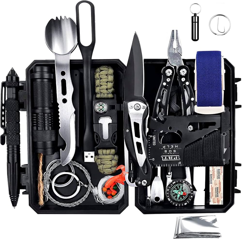
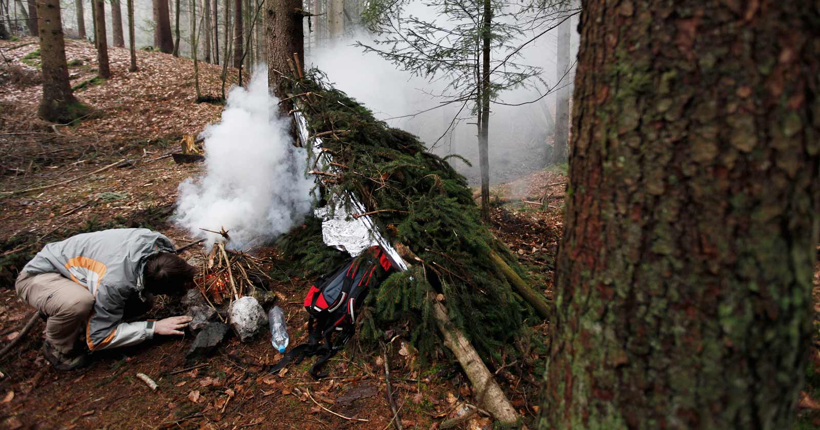


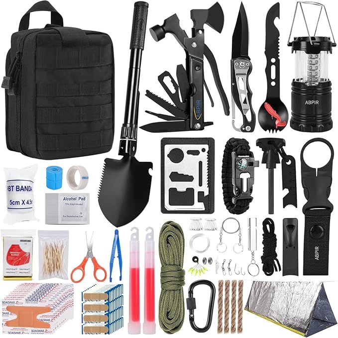


Tags
📧 Get More Articles Like This
Subscribe to receive product reviews and buying guides in your inbox!
We respect your privacy. Unsubscribe at any time.